I went for a long (roughly 3000 km) drive around northern Ontario. Well, not all that far north; I didn't end up much more than about 51 degrees north. But it's a long way from Toronto.
Many of the links below are to photos I took while on holiday. Be forewarned - some of them are fairly large. If you'd rather view thumbnails of them, you'll want to go to http://www.stevedunn.ca/photos/northern_ontario/. There are also a number of links which will lead you to maps, to show you where in the world I went.
Wednesday 1 July: I spent pretty much the whole day in the car; it's about 750 km from Toronto to Cochrane, my destination for today. The road from Toronto up to Orillia is reasonably familiar to me, and I'd been as far as Huntsville a couple of times, but beyond that it was all new. You can see the scenery changing as you go along - from the relatively flat land near Toronto, through the Canadian Shield partway north, and then to relatively flat land again near the end of the journey.
At Latchford, there is a sign reading "Best little town by a dam site!" As you might have guessed, it's a little town at the site of a dam on a river (the Montreal River).
Much of Highway 11 north of Huntsville, and again some of the highway north of North Bay, is under construction. It's a big pain in the butt, particularly since you usually get stuck behind a heavily-laden transport truck which can't accelerate uphill away from the construction area, but I can't really complain. After all, the government has neglected roads, particularly in the north, for a long time, and it's nice to see some of my tax dollars doing useful work.
Cochrane is a pretty small town - you don't need a car to get around the place. My hotel was at the south end of town, but the downtown area was only maybe a ten minute walk away. I walked into town in the evening to watch the fireworks. They didn't get underway until about 10:30; with being so far north, the day is quite a bit longer than in Toronto. The fireworks were set off by the local firefighters, who didn't show a great deal of artistic talent. I overheard a teenager complaining that Cochrane's fireworks always suck. In terms of quantity, though, they were fine - actually, more than you'd expect, considering how small the tax base that has to pay for them is.
The fireworks were set off in the area behind Commando Senior Public School. I didn't ask if you have to go commando in order to graduate. As far as I can tell, the school got that name because it's situated on Commando Lake (see my comment below about the word "lake").
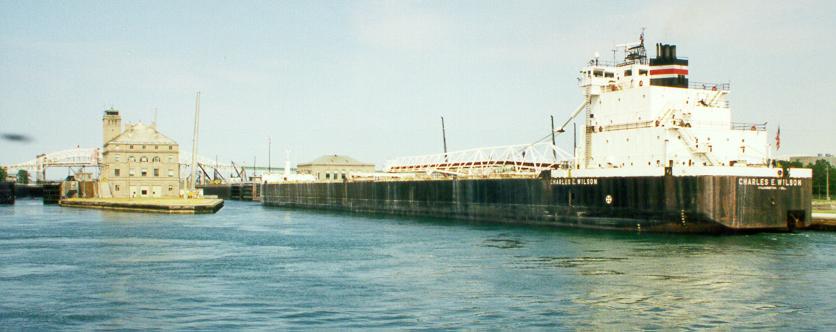
Thursday 2 July: I took the Ontario Northland Polar Bear Express train up to Moosonee. Moosonee is the northern terminus of the railroad, and that's about the only way to get there. There are no roads between Moosonee and points south; you take the train, fly in, come in by water, or by snowmobile in the winter.
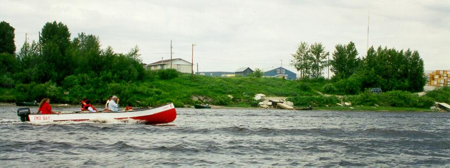
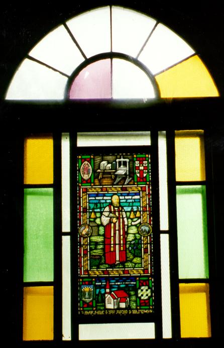
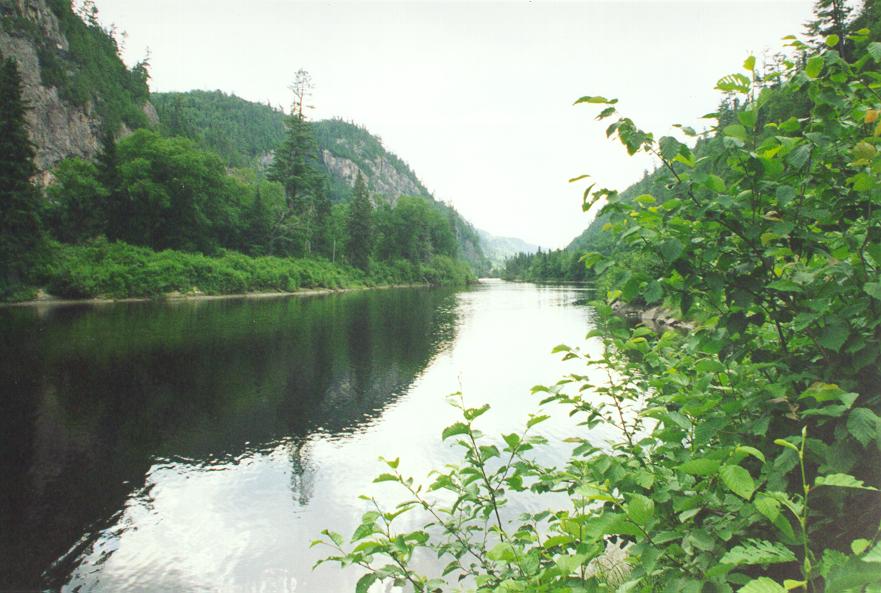
I took a freighter canoe to Moose Factory, which is on an island in the middle of the Moose River. Moosonee and Moose Factory are just a few kilometers inland from James Bay, and the Moose River is tidal at this point. The tide was partway out when I was there, so the canoes had to take a roundabout route across the river, because there are sandbars and shoals in the middle of the river. There's a beautiful stained glass window in St. Thomas Anglican Church in Moose Factory.
Moose Factory was an old fur trading post operated by the Hudson's Bay Company centuries ago. It didn't get its name because someone thought that they made moose there. Moose comes from the name of the river, and Factory is named after the administrator who ran the place. The job title of the person who runs a Hudson's Bay Company fur outpost was "Factor", and so there are other places which are called something-or-other Factory for the same reason.
Moosonee is much more recent than Moose Factory. At the start of the 20th century, the Revillon Frères decided to set up their own network of fur trading posts to compete with the Bay. They picked Moosonee.
Some of ONR's rolling stock is very old, and much of it was bought secondhand. Some of the passenger coaches still have traces of their history with CNR or VIA, and I saw a boxcar that was over fifty years old.
ONR's tracks are not welded, as is common practice around Toronto. They're separate rails. Maybe this contributes to the rough ride and relatively low speed limits. I later noticed that none of the railway lines I saw in northern Ontario use welded track. My guess is that with the extreme temperature changes and with the ground freezing every year, welded rails don't allow for enough contraction or for the ground movement.
You can impress the entertainers on the southbound trip by singing a duet with one of them. I sang the harmony part to "All I Have To Do Is Dream" and surprised the heck out of the singer.
Friday 3 July: Back on the road. This is another day of about 750 km, travelling from Cochrane to Thunder Bay. The scenery is mostly pretty boring - mostly flat land, covered in millions of trees. Trees are good, of course, and a forest can be scenic. But several hours of forest gets monotonous.
Much of northern Ontario is French-speaking. Most of the residents, and pretty well all of the younger ones, are fluently bilingual, but the first tongue of many people is French, and you'll hear it spoken everywhere you go. The town of Hearst is a good example. It's so French that the sign in front of Tim Horton's reads "Toujours Frais". Another sign in Hearst proclaims that it has the last McDonald's for 500 km. What a hardship for travellers to have to suffer!
There are little bits of construction going on here and there along the highway, but on either side of Long Lac, it's really bad. There are sections of 10-30 km where the pavement has all been ripped up. In one area, I drove past two signs, about a kilometer apart, warning about the end of the paved surface. Not much use, since both were in the middle of one of the long gravel sections. Duh.
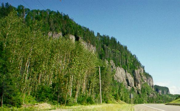
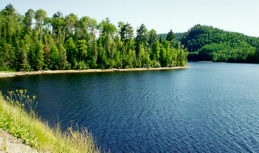
I mentioned that the scenery is mostly pretty boring. However, as soon as you get to Lake Nipigon, it suddenly becomes spectacular. You're back into the rocky part of the Canadian Shield, so you're going up and down hills. And you get to see nice big cliffs, and pretty lakes. It's gorgeous country.
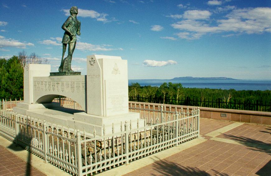
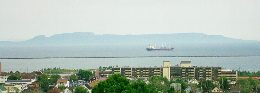
Shortly before you reach Thunder Bay, you can find the Terry Fox Memorial. It's not actually at the point where lung cancer put an end to Terry's heroic Marathon of Hope; they picked a scenic outlook about 10 km farther west. You can see the Sleeping Giant in the background.
Saturday 4 July: Today's topic is signage. There are lots of signs all over Thunder Bay giving directions to popular places and tourist attractions. But highways 11B and 17B twist and turn through the downtown area, and only some of these turns are marked.
Sleeping Giant Provincial Park is off the Trans-Canada Highway, but do you think there's a sign anywhere near the exit telling you where to leave the highway to find the park? No. And when you get to the parking lot that's at the trailhead of several hiking trails, the sign on the booth says that you can pay your park entry fee there - but the booth is unmanned. The ticket you get for not having paid your fee says where you were supposed to have paid - but it's a bit late at that point. The guy manning the park office said that lots of people were complaining about the lack of correct signs, and so he tore up the ticket and let me just pay the regular fee.
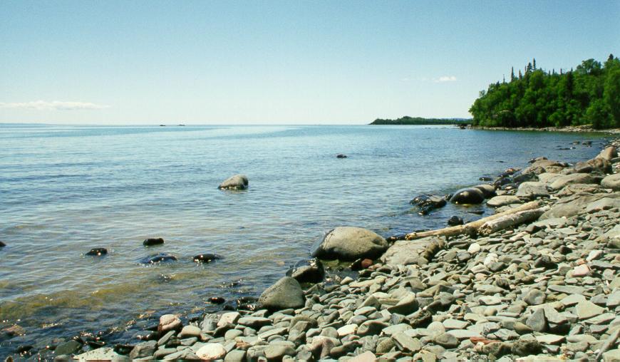
I went hiking in Sleeping Giant Provincial Park. There's a very nice hike that leads to an area called the Chimney. It's not really rock climbing - you don't need any special training, ability, or equipment for it - but it's quite steep and you are climbing on rocks. And the way down is somewhat dangerous, given that much of the steep section is nothing but loose dirt. The view from the top is beautiful, though. There are also lovely views of Lake Superior as you hike.
Sunday 5 July: Today's rant is about painted road markings. You know, things like turn arrows and lane markings. In most cities, you can find places where they have faded, but for the most part, you can see at least some of what's painted onto the pavement. In Thunder Bay, it's the other way round. On most streets, you get the idea that at one time, perhaps many centuries ago, there were markings, but they've been neglected and have nearly vanished. This is fine on streets which are straight and of constant width, but many streets in Thunder Bay have curves in them, and quite a few vary in width. It's particularly hazardous going around a curve on a four-lane road, and you and all of the other drivers have to guess where your lanes are.
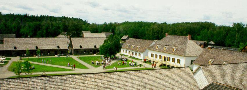
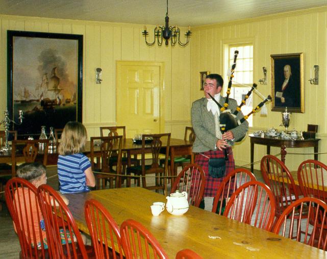
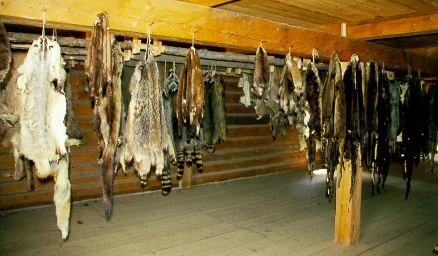
Today I visited Old Fort William. This is a recreation of a very old fur trading post for the Northwest Company. It's not actually on the site of the original Fort William - from what I understand, they built railroad tracks on that location. They hire young people (probably high school or university students) to act as tourist guides, and the guides become characters to bring the place to life.
The Northwest Company was a fierce competitor of the Hudson's Bay Company at the time Fort William was built. Several years later, however, the Bay bought the NWC. Some trivia: what is commonly known as the Hudson's Bay blanket is not actually a Hudson's Bay blanket. Back in the distant past, the design was done by a company which made blankets for both the Bay and for the NWC, and both companies had blankets made with the same design.
One of the buildings, of course, is for inspecting and packaging furs. After all, that's what the place is for. In response to a question from one of the people on my tour ("Don't you get in trouble from animal rights activists for having all these furs hanging in here?"), the guide explained that all of the furs are either confiscated from poachers, or are taken from roadkill.
Avenor has a plant in the south end of Thunder Bay. It smells.
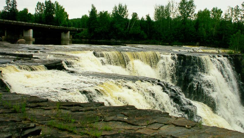
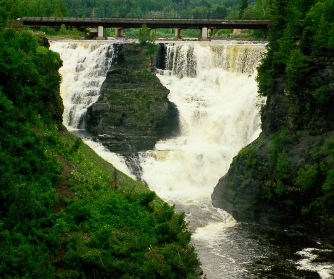
After visiting Old Fort William, I drove to Kakabeka Falls, also called the Niagara of the North (at least in tourist brochures it is). The water is brownish due to tannins naturally leached from vegetation. It's a very nice waterfall. My brother and sister-in-law were there the year before, and told me that at that time, the hydro-electric plant was undergoing construction, and all of the water was going over the falls instead of some being diverted to generate electricity, so the falls looked even better when they were there. After yesterday's rant, you will be happy to know that there are perfectly good signs at Kakabeka telling you where and how to pay for your parking permit.
Monday 6 July: Thunder Bay is one of the few places in the world where amethyst is mined. I visited one such mine, the Amethyst Panorama mine. It's perhaps the most boring mine I've ever visited. But the rocks are very nice, and there's a souvenir shop where I got a number of amethyst souvenirs for people.
I also visited the Thunder Bay Military Museum. This is a small museum located in the Armoury, and is not necessarily open all day. There's also not necessarily anyone there all day to tell you when it's open. But once you find someone to let you in, it's quite interesting.
While I was in Hillcrest Park, taking a picture of the Sleeping Giant, Judith Cameron started chatting with me. Judith appears to be slightly disconnected from reality, but was quite pleasant; certainly, she's much nicer to talk to than the somewhat out-of-it people you'll find, say, in downtown Toronto. Judith asked me to tell the big guy that the world is not really working out the way it should. There are cars that drive themselves into garages without any people on board (she saw this on TV), and this means that children will have no future. Well, Judith, here you go - the whole world now knows what you said.
Tuesday 7 July: I spent the day driving to Sault Ste. Marie. This is close to a full day's drive, if you take the time to stop in a few places along the way. As I travelled south and east, the sunset got earlier; it was at about 10:00 in Thunder Bay, but only 9:30 in Sault Ste. Marie.
I drove past some lakes today with intersting names. One was Fungus Lake. The other was a pair of lakes on opposite sides of the highway - Baby Lake and Mom Lake. Cute.
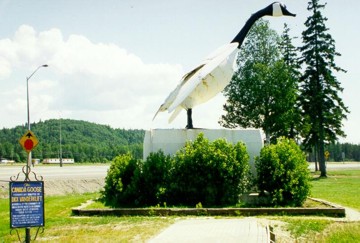
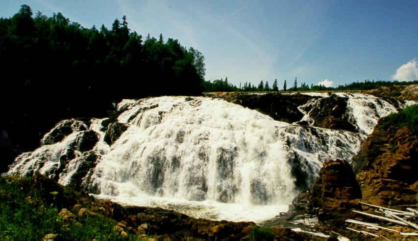
Along the way, I stopped in Wawa. The town takes its name from an Ojibwa word meaning "wild goose" and it has a statue of a goose at its tourist information centre. Just south of Wawa is Scenic High Falls. They're not all that high, but yes, they are scenic.
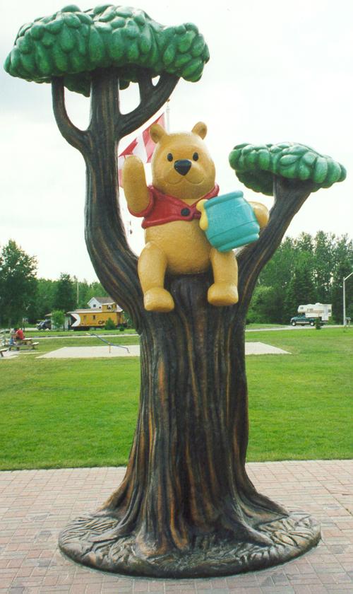
This part of the trip also took me to White River, where there is a statue of Winnie the Pooh. A. A. Milne, the author of the Winnie the Pooh books, named his character after a bear he saw in a zoo in London, England. This bear's name was Winnie, because the fellow who donated the bear to the zoo was from Winnipeg. He was an army officer, and on his way to England during the First World War he acquired this bear in White River. And that's why there's a statue of Winnie the Pooh in White River.
In contrast to the work that I saw on other sections of the Trans-Canada Highway on this trip, the section south of Wawa appears to be ignored. There are a lot of signs that are missing, and there are plenty of places where the guardrails have been mangled by vehicles and no repairs have been made.
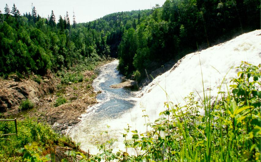
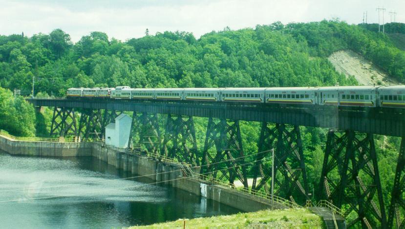
Wednesday 8 July: Today I took the Algoma Central Railway's Agawa Canyon Train Tour. This is a one-day tour that starts from the train station in downtown Sault Ste. Marie and runs about 175 km north to a park in the Agawa River valley. You get off the train, have a couple of hours to wander around the park, then get back on the train and go back to the Soo. It's nice and scenic. There's one spot where the train goes over a curved trestle bridge, and from the rear of the train you can take a picture of most of the rest of the train.
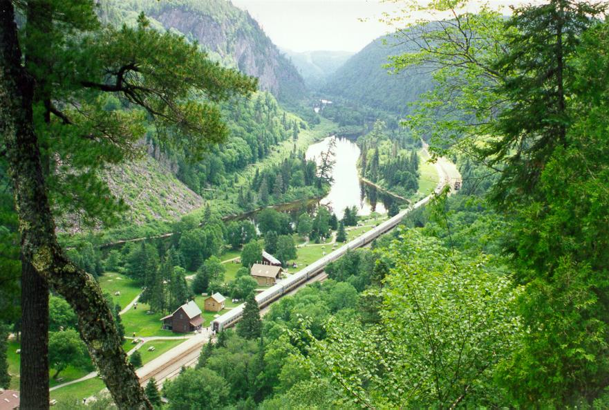
On this day, there was a track gang working on some of the track. The train was delayed while they cleared off the line. You'd think they would know that there was a train scheduled, and that they'd try to keep out of its way, but apparently this isn't how it works. When they finally got out of the way, the train had to back up and take a run at it; this was on an uphill section of the track, and I guess the engineer didn't think he could make it from a standing start. As a result of this, our stop in the park was cut short. But I still had time to climb up the side of the canyon and take a picture very much like one they use in their advertising materials.
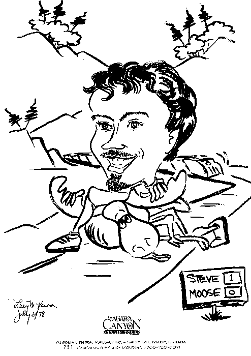
There was an artist named Lucy McKenna on the train, doing caricatures of people. I had her draw a very realistic image of me wrestling a moose to the ground.
Several sections of the track were double- or triple-tracked, but many of these have been abandoned. And for the second time on this trip, I discovered that I have a talent for walking on a moving train without having to hold onto anything to steady myself. Several of the curves are so tight that the train's wheels squealed. And from the snack car, I had the chewiest donut I've ever eaten.
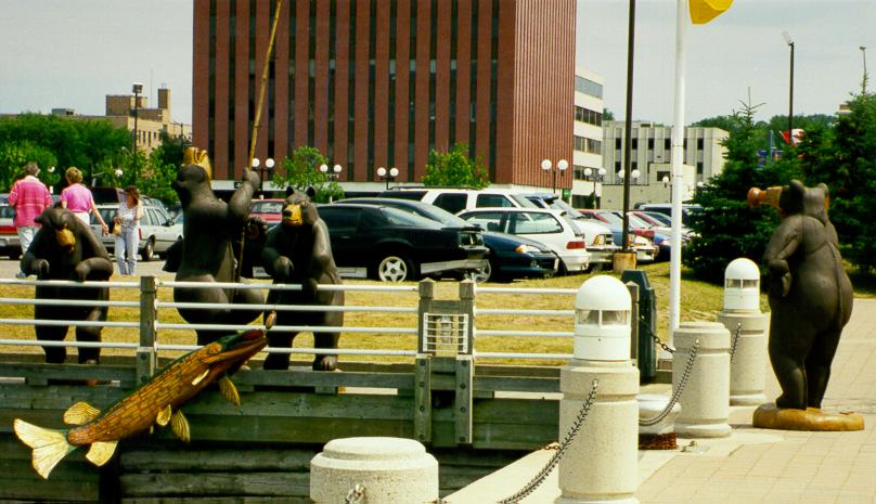
Thursday 9 July: Today, I took a boat tour of the locks in Sault Ste. Marie. Near the docks, there's an amusing statue of three bears fishing, with a fourth taking pictures with a camcorder Very cute, and of course lots of people were taking pictures of it.
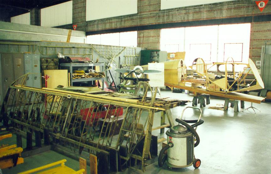
I also visited the Canadian Bushplane Heritage Centre, located in a riverside hangar which used to be used as a base for forest fire fighting aircraft.
Today's rant: well, not so much a rant as a wry observation. There are two hospitals in Sault Ste. Marie. You'd think that if you were going to put two hospitals in one town, you'd situate them so that they're in different parts of town, so that everyone is going to be close to at least one of them. No. They're right next door to one another, just east of downtown.
Friday 10 July: Today was mostly a driving day, from Sault Ste. Marie to Sudbury. Along the way, I stopped at Elliot Lake and visited the Elliot Lake Nuclear and Mining Museum. It's not worth the side trip. However, there was one amusing place along the way, where you find out that explorers sometimes run out of ideas for naming the things they find. Beside the highway from the Trans-Canada Highway into Elliot Lake is a lake named "Lake No. 2."
I also visited the Simpson Copper Mineshaft in the little town of Bruce Mines. This is an open mine dating from before the use of steam power; all work was done by hand or using the power of horses. Most of the mineshaft has been filled in so that it's safe for tourists. My tour guide was a young (teen? pre-teen?) girl who, though cute, wasn't a very self-assured public speaker and seemed unsure of, like, some of the, um, the things she was, like, saying and stuff.
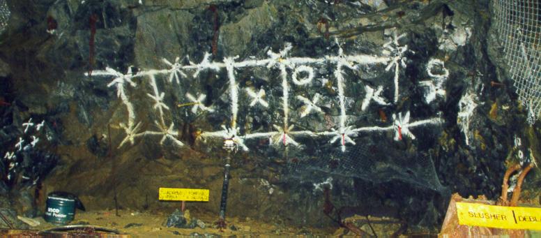
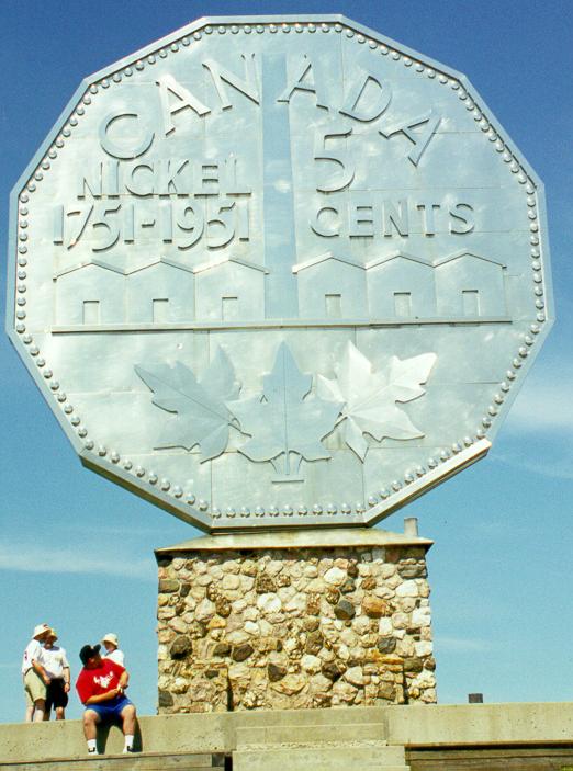
Saturday 11 July: I spent the whole day today touring the Big Nickel Mine and Science North. The Big Nickel Mine never actually was a mine; it's just a hole in the ground that they put tourists in. You can see how they mark where they're going to drill holes and put in explosives, and of course no visit is complete without taking a picture of The Big Nickel.
Today was the day after the Special Olympics ended, and several of the athletes were on the same tour of the mine that I was on. One of them kept picking up "rocks" from the floor of the mine and showing them to the guide, who kept telling her "That's slag."
Science North is way cool. It's interactive and there's tons of stuff to do. For example, you can build cars to put on a racetrack and see if yours is faster than everyone else's. Or you can pet a very wet beaver.
Today, I noticed that there were dozens of abandoned cars along the roadside. Many of them were relatively new. Occasionally, someone would wander out of the roadside ditches and drive one of the cars away. I'm pretty sure this is related to the fact that it was wild blueberry season around Sudbury.
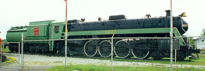
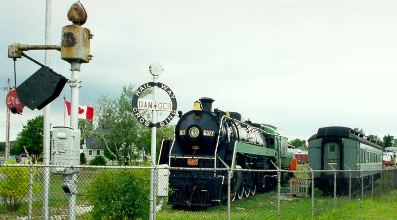
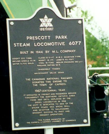
Sunday 12 July: I had originally planned to spend half a day at Big Nickel and Science North yesterday and then drive home, but I was having so much fun I decided to stay an extra day. So today I drove to Capreol, just north of Sudbury, to visit the Capreol Prescott Museum. This is a newly-opened museum mostly about railroads. There are absolutely no signs anywhere in town stating where it is - and when I arrived, they didn't even have a sign out at the roadside saying which building was the museum. But you have to guess that it's near the fenced-in area with a retired steam locomotive and some other railroad equipment.
While I was on holiday, I sent email to some of my friends. In that email was a list of things I had done on my trip. Here is the list.
Well, actually, only half of the above are true. You'll just have to guess!
I noticed a definite pattern. Gasoline prices were higher in areas with only a few gas stations. In larger centres, prices are higher on the highway than in town. Here are the prices I found (in cents per liter); these are the lowest prices for regular gasoline, and may of course vary from time to time.